Sloan Canyon
January – February 2015
SLOAN CANYON
Petroglyphs paint a glimpse of ancestral southern Nevadans.
STORY & PHOTOS BY GREG MCFARLANE
It’s hardly a secret that Las Vegas is the definitive destination for gambling and entertainment; not to mention cuisine and nightlife. But…prehistoric rock art?
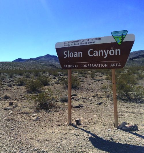
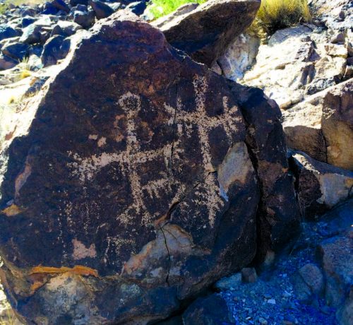
Sloan Canyon—a mere 13 miles south of the Las Vegas Strip—contains one of North America’s largest concentrations of petroglyphs. More than 1,700 images adorn the canyon walls, waiting to be explored by anyone willing to hike a few miles of moderately challenging terrain and step back into a world barely touched by civilization. In 2002, the site was designated as a National Conservation Area (NCA)—one of only 16 in the U.S.—and with good reason; archeological troves like Sloan Canyon don’t come around every day…or even every millennium. Researchers believe the petroglyphs weren’t created as a single project, but rather the work of various peoples from about 2000 B.C. to as recently as the onset of white explorers.
 The entrance to the NCA is less than a mile and a half from the southern reaches of the Anthem Highlands residential development in Henderson. Although it’s on the doorstep of civilization, Sloan Canyon is lightly traveled. The Bureau of Land Management claims an average of 80 visitors a day, but a glance at the sign-in book makes that estimate seem generous. On a cloudless and windless early fall afternoon, this author spent several hours at Sloan Canyon and encountered a grand total of four humans. They were outnumbered by the jack- rabbits, which seemed inconvenienced by the intrusion.
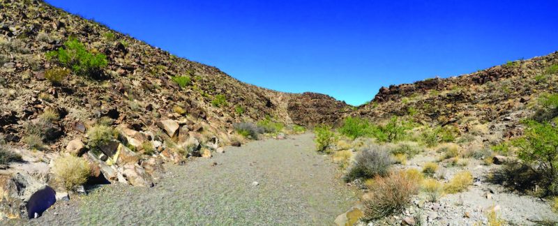
Sloan Canyon covers 76 square miles, much of which is accessible only by the most intrepid hikers. Some of the unimproved roads leading there can be formidable, with the occasional smooth patch interspersed with football-sized rocks that will test the resiliency of any SUV’s axles.
Note: No motorized travel is allowed within the North McCullough Wilderness portion of the canyon.
The sign-in book and an accompanying map at the entrance mark the start of the trail network. The trails are easy to navigate, with no route-finding required. The major trail to the petroglyphs begins in a wash filled with rubble, making the first few hundred yards something of a slog for hiking boots. To see wildlife, arrive around dawn or dusk. Desert bighorn sheep—a favorite subject of the petroglyph artists—congregate along the southern extent of the trails, resting precipitously on the slopes and mocking the slow bipeds below.
The path to the petroglyphs is exposed, with negligible shade throughout much of the day. A little more than a half mile into the hike, you’ll reach a marked fork. Continue south on trail 100, or bear west on trail 200, which loop and rejoin each other. The following directions assume you’ll be doing the loop clockwise.
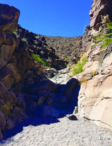
 Trail 100 involves a modest elevation gain. Hiking poles help on the scree part of the trail, but aren’t vital. In fact, they’ll just get in the way when negotiating the brief scrambles that mark the approach to the petroglyphs. Hikers must climb over three dry waterfalls, the last of which is slick enough to potentially compromise one’s footing and offers little margin for error. A short, unaccompanied hiker can be in for a challenge. Proceed slowly and purposefully: this quiet, remote gully is no place to dislocate an ankle. Although yelling for help will produce a rich echo.
Approximately one and a quarter miles from the parking area, the petroglyphs begin. They’re unmistakable: the images are remarkably well preserved, thanks to both the resiliency of the rocks and their out-of-the-way location. Even in the Ancestral Puebloan era, Sloan Canyon had few visitors. But no matter in which century you happen to hike the area, it goes without saying that responsible visitors keep their hands on their cameras and off the petroglyphs.

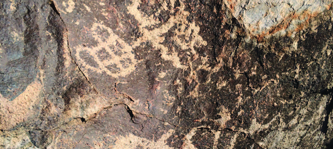
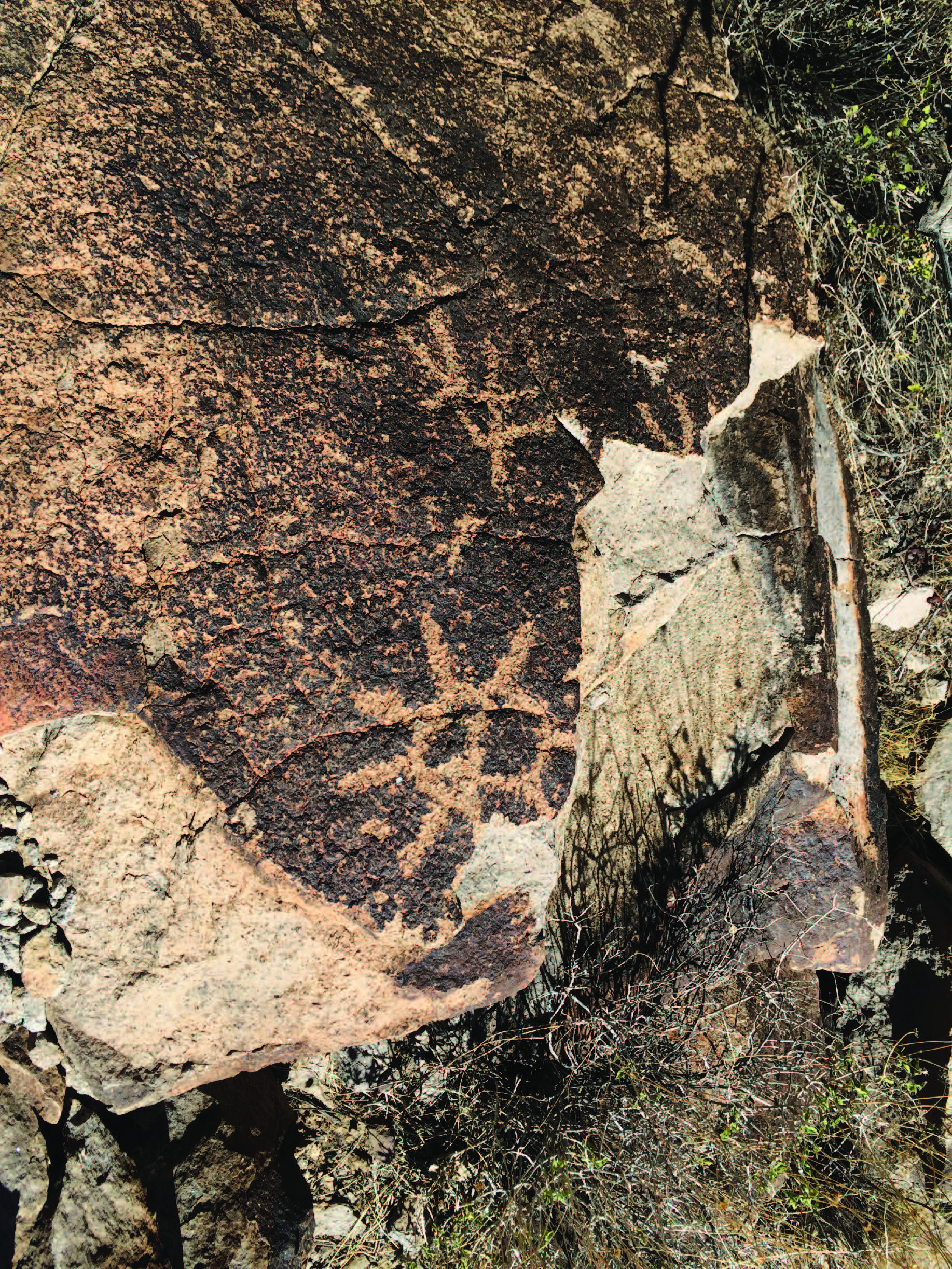
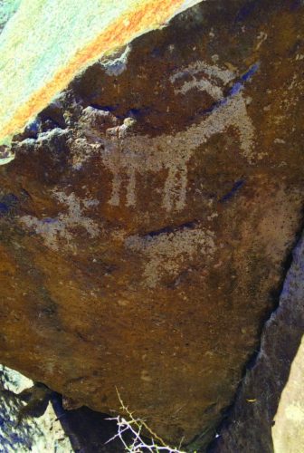
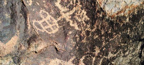
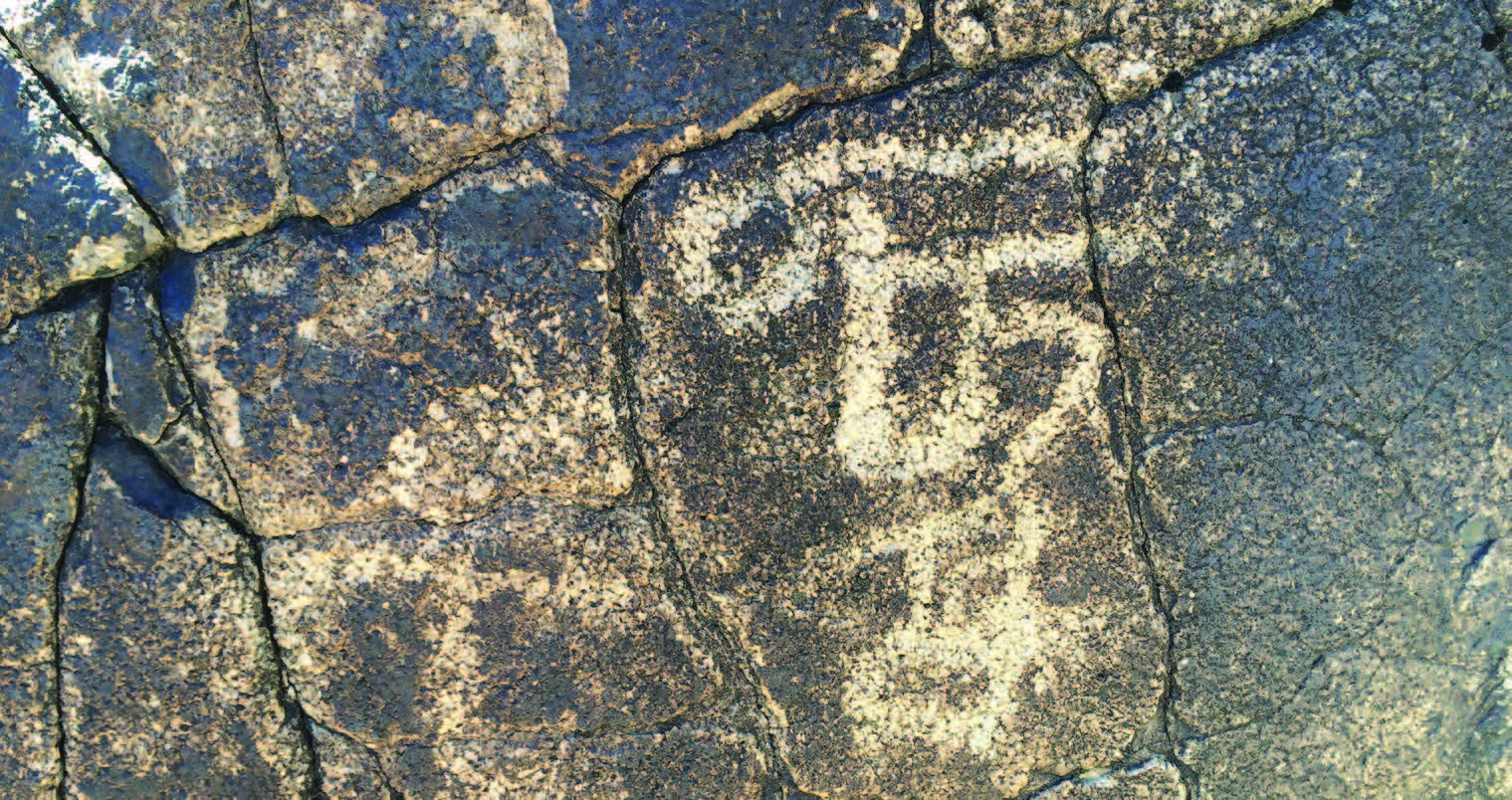
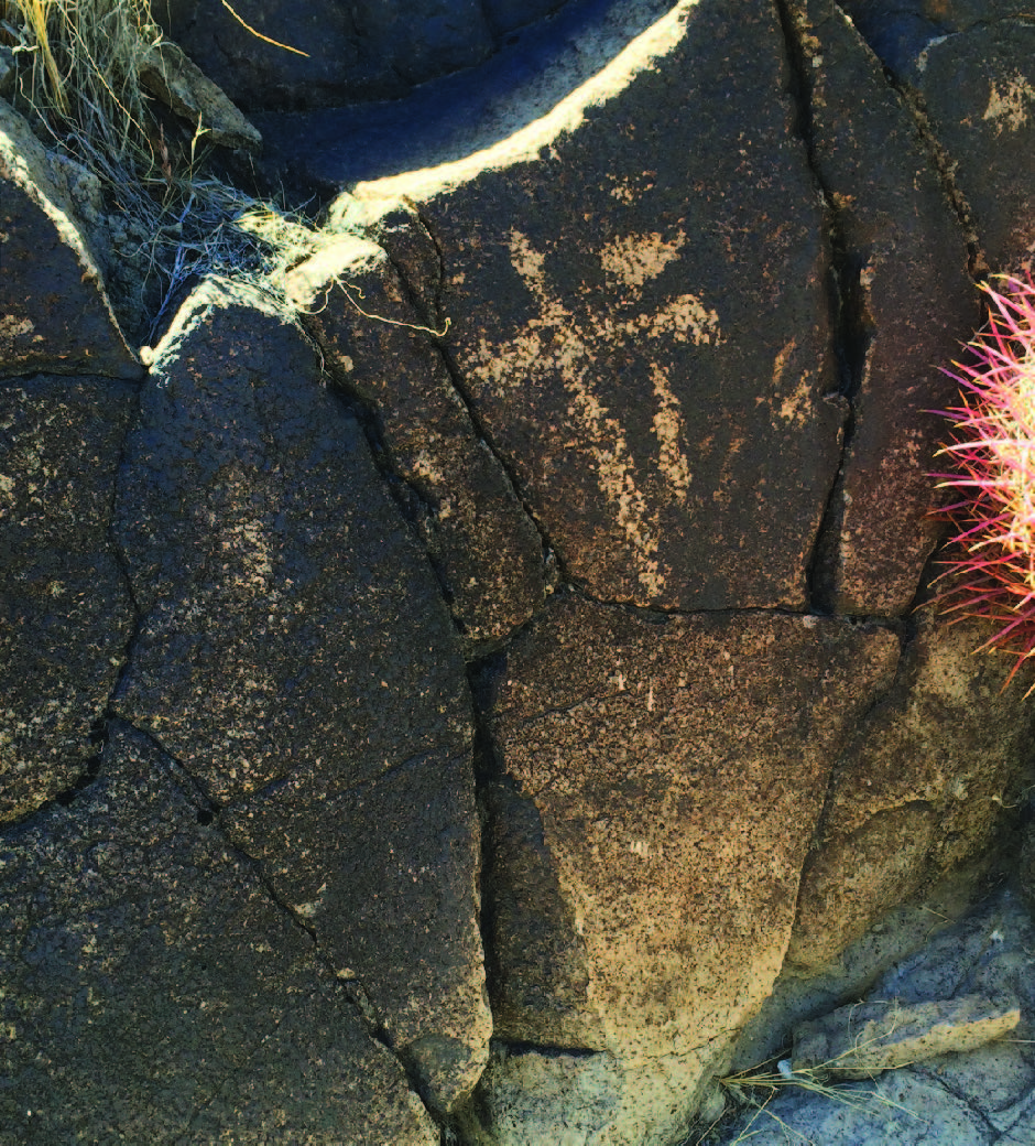
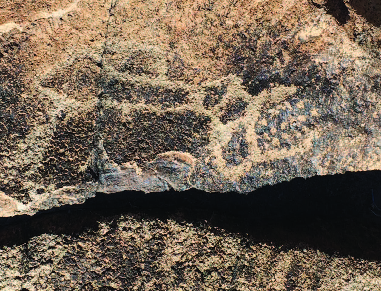
The works depict human figures, animals, and the occasional eerie geometric design that a fanciful imagination might regard as a record of alien contact. Many of the petroglyphs are abstract; their meaning not immediately evident to anyone but the long-dead artists. The most notable appear on a single east-facing wall that serves as the gallery’s foyer. These renditions of hunters, gatherers, and their quarry are aligned in a canyon bed that traverses north-south. The result is that the contrast between rock surface and patina changes as the sun traces its arc overhead from mid-morning to late-afternoon, making for a different set of images with each hour. Among the most compelling petroglyphs are the representations of riders on horseback, doubtless signifying the arrival of the Europeans who were to forever transform the surrounding area.
A small representation of the myriad rock art in Sloan Canyon. While the petroglyphs are predominantly abstract, you will find examples of anthropomorphic and zoomorphic art along the walls. For more information on the petroglyphs visit friendsofsloan.org.
Getting There
 There are several ways to get to Sloan Canyon, each of varying difficulty. Whichever one you choose, you’ll need a high-clearance vehicle. Four-wheel drive isn’t mandatory, but it never hurts.
 The official BLM directions describe the straight- est, bumpiest route. From Interstate 15, take exit 25 and head east one block to Las Vegas Boulevard. Continue north for .1 miles, to an unmarked dirt road, and go east. Follow the power lines for 4.1 miles. The poles are numbered. At pole 12084, you’ll see a small marker indicating the conservation area. Turn right, head south 1.1 miles and you’ll reach the gate. Park and walk.
There’s a much easier, less publicized route that begins on the outskirts of Henderson. From the intersection with Volunteer Boulevard, head south on Via Inspirada, which, 1.2 miles later, makes a pronounced left turn and becomes Bicentennial Parkway. Heading east for 500 yards, you’ll cross over a wash. Immediately turn south and continue on an unmarked dirt road. Seriously, the road is right next to the wash; if you continue on Bicentennial Parkway to Via Firenze, you’ve gone too far.
Drive alongside the wash for 1.1 miles, at which point you should see the aforementioned power lines. Turn right (west) over the flood channel (don’t worry, there’s an overpass) and follow the power lines .3 miles to pole 12084.


PLAN YOUR TRIP
BLM Red Rock Canyon Office
1000 Scenic Loop Drive, Las Vegas, NV 89161 702-515-5350