Cooling Off Naturally: Waterfalls
July – August 2017
10 Wow-Worthy Places to Catch the Spray
BY PAUL SEBESTA
Envisioning the country’s driest state with natural waterfalls is a weird and wonderful notion. The waterfalls of Nevada are a beautiful fortune awaiting the intrepid explorer and they steal the show in their unexpectedness.
My wife and I found 10 plunges that absolutely took our breath away. We measured these waterfalls not by volume, but by their unexpected nature—quite simply, their wow factor.
Dry state? Soak it in.
10. Lost Creek Falls
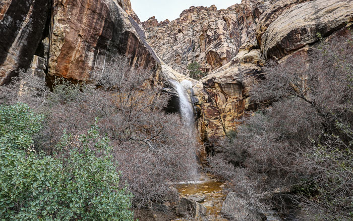 Location: Red Rock Canyon National Conservation Area, Clark County
Lost Creek Falls. Photo by Shaun Astor.
Southern Nevada, bombarded by relentless sun, is also blessed with several amazing waterfalls and Lost Creek starts this list with a bang. Much can be found here on a hot summer’s day: friends, family, and pup included. After an easy 3/4-mile hike you’ll be rewarded with a 200-foot splash. The water has carved out a mini cave at the base of the falls allowing you to stand beneath and behind the falling stream, one of the only falls like this in Nevada.
From Red Rock Canyon N.C.A., follow signs for Willow Springs Picnic Area and Lost Creek Trail on Rocky Gap Road. It’s a popular trail; expect to share it with some crowds.
9. Falls Creek Falls
Location: Santa Rosa Range, Humboldt County
If you’ve never heard of Falls Creek, you’re not alone. Find this one at the head of Horse Canyon on the steep western foothills of Granite Peak, the highest peak in the Santa Rosas. Falls Creek plunges 45 feet over dramatic phyllite cliffs into a churning pool. If you don’t mind battling the brush to reach its base, you’ll witness bellows of lovely clouds of spray, perfect for the dog days of summer. If you come in the winter you’ll even find sheets of ice clinging to the innards of the steep canyon walls! Falls Creek is completely exposed so bring plenty of sunscreen and essential supplies.
Falls Creek Falls is only 40 minutes north of Winnemucca. From U.S. 95 find the sign for Horse Creek about 10 miles north of State Route 290. Though the road is suitable for passenger cars, it can eat tires very quickly. Head in the direction of the mountains and the road will end at the head of Horse Creek Canyon. Park and walk the easy 1,000 yards to the waterfall.
8. Mary Jane Falls
Location: Spring Mountains, Clark County
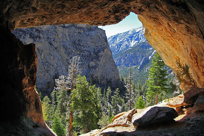
This snow-fed desert waterfall is on southern Nevada’s highest peak, found 2 miles into a hike on the flanks of Mt. Charleston. Although people do come for the waterfall, Mary Jane’s panoramic view is the real reward here. Mary Jane is a rivulet of snow melt that tumbles some 250 feet over a rock ledge, resembling more of a shower than a waterfall. In fact, many southern Nevadans make the annual pilgrimage to shower at Mary Jane. Stand beneath the ice-cold droplets and gaze out to a gorgeous view below.
Mary Jane Falls has its own marked trail and parking lot at the end of Kyle Canyon Road (State Route 157), about 30 minutes west of U.S. 95 north of Las Vegas near Mt. Charleston Village.
7. Big Falls
Location: Spring Mountain, Clark County
In addition to its monster height, Big Falls is the only true horsetail type of falls on this list. Arrive here during a good water year, and this one almost resembles a miniature Yosemite. The trail to Big Falls is more suited for the intermediate to expert hiker so think hard before bringing the little ones. The unofficial trail splits off from Mary Jane at a signed junction for a former campground. The overall moderate hike is about 4 miles round-trip, but it is worth the tough scramble on the last leg.
At peak runoff, Big Falls slices 350 feet down limestone cliffs and collects into a milky pool of water high above the canyon—making this hidden beauty a great summer destination just north of Sin City.
6. Tamarack Peak (Galena Creek) Falls
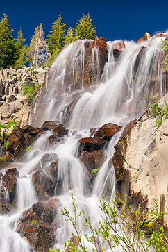
This lovely plunge is just one of many surprises awaiting hikers on the Mt. Rose Trail and one that surprisingly few Nevadans know about. At roughly 9,600 feet above sea level, Tamarack (often called Galena) is the highest waterfall on this list—located at a halfway mark to the Mt. Rose summit from the parking area. The headwaters of Galena Creek tumble an impressive 82 feet over a granite ledge where at its base we’re treated to a spanning view over a meadow with a distant Reno and the Truckee Meadows far below. If that weren’t enough, this pretty thing flows all year and almost always includes a generous display of wildflowers around mid-July. This is an attainable locale for any Nevada bucket list. Tamarack would earn a higher spot on the list if wasn’t completely exposed without shade at such a high elevation.
From the parking area on Mount Rose Highway (State Route 431), expect to reach Tamarack Falls in about 2.5 hours. This hike is extremely popular, but no less rigorous so expect a few crowds on the way. Take it slow and bring plenty of sunscreen.
5. Hunter Creek Falls
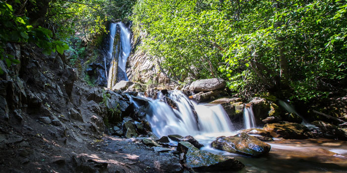
Location: Southwest Reno
Hunter Creek Falls. Photo by Shaun Astor.
The lowest of the cascades along Hunter Creek is one of the most beautiful waterfalls in the state. Hunter Creek Falls isn’t the largest waterfall on this list, but what it lacks in size it makes up for in its lovely setting and relatively short hike from a major urban center. It has the ability to stop your heart and take your breath away.
Hunter Creek is a 30-foot cascade of snowmelt squeezed through a shaded forest. In fact, its profile and setting is something right out of the Pacific Northwest. We urge you to visit on overcast or rainy days; you’ll think you’ve found yourself in Olympic National Park or the Columbia Gorge. Depending on the time of year you may find it muddy, clear, milky white, or even a graceful glacial blue color.
Located so close to Reno, Hunter Creek has a few crowds. Try to hike during the week and you’ll have the place mostly to yourself. Look for the Michael D. Thompson Trail head at the end of Woodchuck Circle from Caughlin Parkway in southwest Reno. The hike begins on a long exposed stretch of desert steppe, so bring extra sunscreen to combat this portion of trail. The hike becomes moderately difficult as it directs itself into piney confines of Hunter Canyon. Expect about 2 hours one-way.
Looking for other ways too cool off naturally? Check out Cooling Off Naturally: Kayaking
4. First Creek Falls
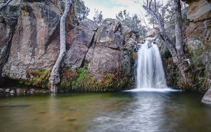
Location: Red Rock Canyon N.C.A., Clark County
First Creek Falls. Photo by Shaun Astor.
At only 7 feet, this is the smallest waterfall on the list, but don’t be fooled. There is absolutely no other plunge like it in Nevada and when you see it you’ll see why it’s so high on the list. Head west out of Las Vegas toward Red Rock Canyon N.C.A to a well-marked trail head to First Creek along State Route 159. First Creek is located between the Red Rock fee area and Bonnie Springs Ranch.
Once you endure the 2-mile hike across open desert, the trail suddenly enters a shady box canyon where right before your eyes, a stunning little horsetail of water spills into a large punch bowl filled with fish. Punch bowl-type falls are extremely rare, so needless to say we’re a bit elated to have one here in Nevada.
3. Waterfalls of Thomas Canyon
Location: Thomas Canyon, Ruby Mountains
This series of plunges takes us into the spectacular innards of Lamoille Canyon, 30 miles south of Elko in the Ruby Mountains. Thomas Canyon is a destination that’s still a bit under the radar, but what you’ll find there is a glacially carved side canyon that will regularly reward you with stunning hidden waterfalls. The 5-mile trail to the top begins at the campground and thanks to year-round melt, you can expect to come across several waterfalls along the way throughout the year.
Rather than pick a single fall we’ve decided to label them all as one smorgasbord of uniquely different waterfalls. Reaching the very last waterfall is a bit tricky and recommended only for the bravest of souls. Thomas Canyon is extremely steep with the last 2 miles of trail recommended only for expert hikers and backpackers. Two of the nine waterfalls overlook the canyon far below, meaning some technical skills might be required to reach these.
2. Kings Canyon Falls
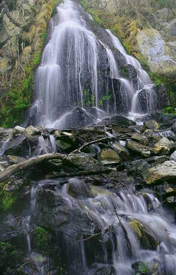
Mother Nature needed just 25 feet to shape this breathtaking waterfall. Hidden on the outskirts of the state’s capital is not only one of the most ravishing falls in Nevada, it’s also very easy to reach. The trail to Kings Canyon is less than a mile long, making it the ideal fun date with the pup and kids. You also have a great chance of seeing wildlife along the way.
The best thing going for the waterfall is its gorgeous profile. Kings Creek plunges over three steps of granite via a hard cascade, then streams a broad veil of water sheeting down some 25 feet into a shaded box canyon. It’s hard to visualize this waterfall, but you can visualize this: Kings is only seven minutes from the Nevada State Capitol. This one will certainly leave you uttering wow if you can hear yourself over the incredible roar.
As the easiest waterfall to reach on this list, its close proximity to an urban center, and its absolutely stunning visual appeal, it was a toughie not to place this one at the coveted No.1 spot. So what waterfall could possibly top it? Only something in the most unlikely of places.
1. Stonewall Falls
Location: Nellis Air Force Range, Esmeralda County
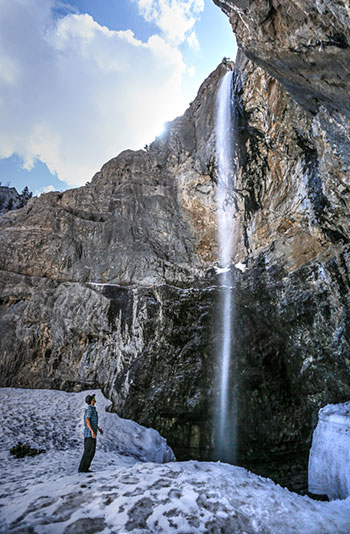
After roughing it on lonely dirt roads and passing through the perimeter fence of the Nellis Air Force Range and Nevada Test Site, we arrived at a giant slash on the west side of Stonewall Mountain. We found out that the giant cleft before our eyes was known as Stonewall Falls.
While Stonewall is barely more than a trickle, in this particularly arid region this tiny rivulet is priceless. So, why does it earn No. 1? The notion of running across any type of waterfall is probably the last thing you’d expect in this desolate region of the state. And this precisely is why it earns the title. It isn’t the mind-stopping height of Big Falls, the oasis of First Creek, or the refreshment of Kings Canyon, but no other waterfall stole our hearts as instantly and infectiously as Stonewall.
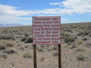 Stonewall Falls is fed by year-round Stonewall Spring and uniquely stair steps some 400 feet into a tiny pool. The flows are diminutive compared to Hunter or Falls Creek, but if there ever was an oasis in the desert, Stonewall wipes the floor with all the other entries on this list. As tempting as it is, please avoid camping here as our furry friends greatly depend on this vital trickle.
Directions: Finding Stonewall Falls requires navigating a series of complicated road junctions after you turn off of U.S. 95.
Clear your odometer as you head south from Goldfield on U.S. 95 and look to the left for a graded dirt road with a gate 14.4 miles out of town. Reset your odometer as you turn here and don’t forget to close the gate behind you. Follow this road for 2.9 miles to a fork, bear right, and follow the graded road to the east. Look for another road going off to the right 3.9 miles in from the highway. Continue east on this dirt track, and in 1/2 mile you will reach the perimeter fence to Nellis Air Force Range and Nevada Test Site. You’ll see a sign stating you must remain on the road to avoid trespassing on the test range; heed this warning. Pass through the gate (closing it behind you) and continue toward a giant slash in the mountainside.
You can find more about all these waterfalls at nv-landmarks.com


