Odyssey of a Ghost Town Explorer Part 11
September – October 2019
FIRE & BRIMSTONE
BY ERIC CACHINERO
Oily indigo smoke billowed from a circular opening in the top of a strange beehive shrine, marking the near completion of a process as foreign as the 1800s Nevada frontier had ever seen. Weeks prior, cords of juniper and pinyon were lain into the rocky tomb, set ablaze, and cooked in the oxygen-starved environment, as observant eyes kept watch of the smoke, and attentive hands operated a series of flues. At first, the smoke burned white, then yellow for a couple days, then dark blue, marking the completion of the process.
An uninformed Nevada frontiersman who witnessed these makeshift mausoleums may have attributed the colossal bulbous structures to the occult, maybe even gone as far as to believe they were a portal to the underworld.
But their true purpose was far less ominous.
Charcoal kilns played an important role in the early days of Nevada prospecting, and their sentinel skeletons exist as a reminder to their significance. Charcoal was desired because it burns much hotter than wood, and allowed prospectors to smelt their silver and gold ore, separating the precious metal from the waste rock.
Nevada has several sites where these charcoal kilns can be found. Some, like the Ward Charcoal Ovens near Ely, were major operations, while others were lesser-known and more primitive.
BURNING SUNSET
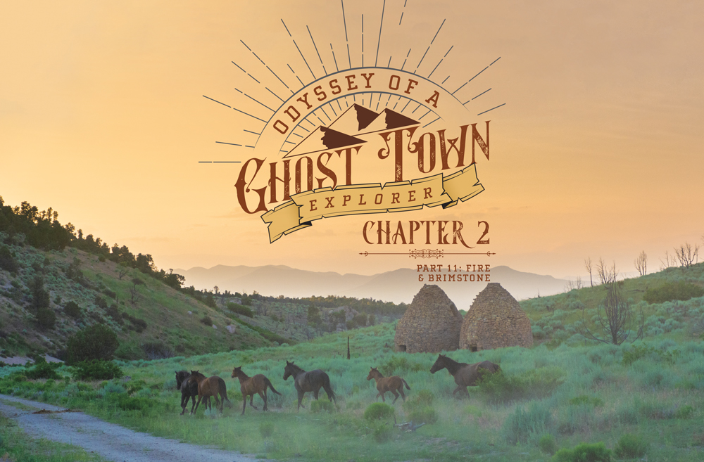
After driving from Carson City to southeastern Nevada, Managing Editor Megg Mueller and I find ourselves racing up a washed-out dirt road to reach the Panaca Summit Charcoal Kilns before the fleeting daylight leaves us blind. As luck would have it, a band of wild horses let us know we’ve reached the two kilns, just as the last flakes of golden light fade into the night sky.
The kilns at Panaca Summit were built by pioneers in the mid-1870s, and were used to support the nearby silver mills at Pioche and Bullionville. The kilns owe their roots to skilled stonemasons that quarried rhyolitic tuff from area outcroppings, before shaping the rocks and assembling them with mud and mortar into the familiar shape. The giant ovens were operated by Swiss and Italian woodcutters—known as the carbonari—who perfected the charcoal-making process in Europe and brought their skills to the Nevada mining camps. Around the turn of the century, the mills at Bullionville closed, and the charcoal kilns were abandoned.
We poke around the kilns for a bit, in absolute awe at their size. Each stands about 20-feet tall, and is in remarkable shape considering its age. Impressively, the musty aroma of stale charred wood can still be smelled in each kiln, though remnants of campfires inside may be to blame. The sun sets completely just as we start our descent to Wright’s Country Cabins in Pioche, our ghost-town basecamp for the next two nights.
SMOLDERING SUNRISE
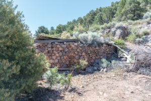
We’re on the road early, headed north out of Pioche for the ghost town of Jackrabbit, which is conveniently located just off U.S. Route 93—so we think. A Nevada historical marker lets us know we’ve reached the site, though tall juniper and pinyon pines camouflage the town’s remains, leading us on a bit of a search before concrete ruins let us know we’ve reached the townsite.
Jackrabbit’s story, if true, begins with one of the luckiest Nevadans in the state’s history. Lore maintains that a prospector bent down to pick up a rock to throw at a jackrabbit, only to find himself holding high-grade silver. After the initial discovery on the east side of the Bristol Range in 1876, a modest town sprung up, with all the era comforts. Jackrabbit was said to be the last whiskey stop for travelers heading south to Pioche. The booming town would see a drop in ore production during the 1880s that almost led to its demise. A 15-mile narrow-gauge railroad was built between Jackrabbit and Pioche in 1891, which led to a brief increase in mining, but by 1893, operations had mostly come to a halt.
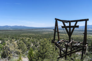
For such an old ghost town, there’s much to explore at Jackrabbit. The highlight is the massive mineshaft, complete with ore cart tracks that protrude and twist from the giant hole. On this hot day, standing next to the barbed-wire fencing, the rushing cold air coming from the mineshaft feels like someone turned on the world’s most-powerful air conditioner. The air even has a creepy mist to it, leading us to keep our distance after the initial discovery. In addition to the mineshaft are remnants of a suspended aerial tram used to transport ore to Jackrabbit from the nearby silver camp of Bristol. We spend quite some time at Jackrabbit before pressing on to our second charcoal kiln site of the trip: Bristol Well.
KILN TRIO
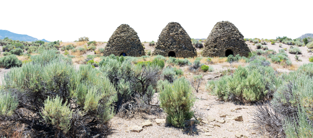
Bristol Well (sometimes written Bristol Wells) is a short drive from Jackrabbit. As the heat of the day begins to set in, I’m reminded of the absolute dryness that engulfs this area. That, coupled with an overabundance of pesky flies, leaves me in admiration of the pioneers that called this place home. As we drive, we spot several structures in the distance, letting us know we’ve reached the town.
Bristol Well is not to be confused with the nearby Bristol mining camp, which, according to several online sources, is a ghost mine now deemed to be hazardous to human health and is located on private property. Bristol Well, on the other hand, was the support community for the Bristol mining camp, providing well water for mining activities. In 1872, a furnace was built to treat silver-lead ore from the nearby mines, and by 1880, the town had a five-stamp mill, smelter, and three charcoal kilns. By 1890, copper was being recovered from nearby mines, leading to a population of around 400. Mining activity continued intermittently over the years, before fading out during the late 1910s.
The kilns at Bristol Well are equally impressive to those at Panaca Summit, though they are in a bit rougher shape. The tops and sides of the kilns are eroding or breaking, likely due to people climbing on them. Nevertheless, their strangely intoxicating beauty is undeniable. It’s odd that these manmade objects stand out like a sore thumb against the desert background, yet almost look as though they belong.
THE JUDGE
We head back to Route 93, and make the more-than-50-mile-round-trip journey to the ghost town of Atlanta, which turns out to be a major letdown. From there, we decide to make the long journey to the ghost town of Fay, After passing through the beautiful Echo Canyon State Park, we continue east, weaving across a small creek and through dense canyons before reaching a place called Deer Lodge, located close to the Nevada-Utah border.
Deer Lodge was formed in the late 1800s as a mining camp, though it never really grew much beyond a feed store, saloon, and post office, which only operated for two years. Deer Lodge and the nearby mining camp of Fay would fade at the same time, though the former would last thanks to the Hackett family, who shifted their livelihood from mining to ranching after the silver dried up. The Hacketts would raise several generations at the remote ranch at Deer Lodge, even opening an official school on the property. Because the Hacketts had five school-aged children in the late 1920s, and more than five children were required to become an official school, several other area children were boarded at the ranch to keep the school open. The Hackett family lived at the Deer Lodge ranch through 1959, before it passed amongst a host of private buyers over the years.
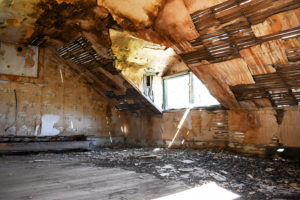
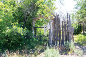
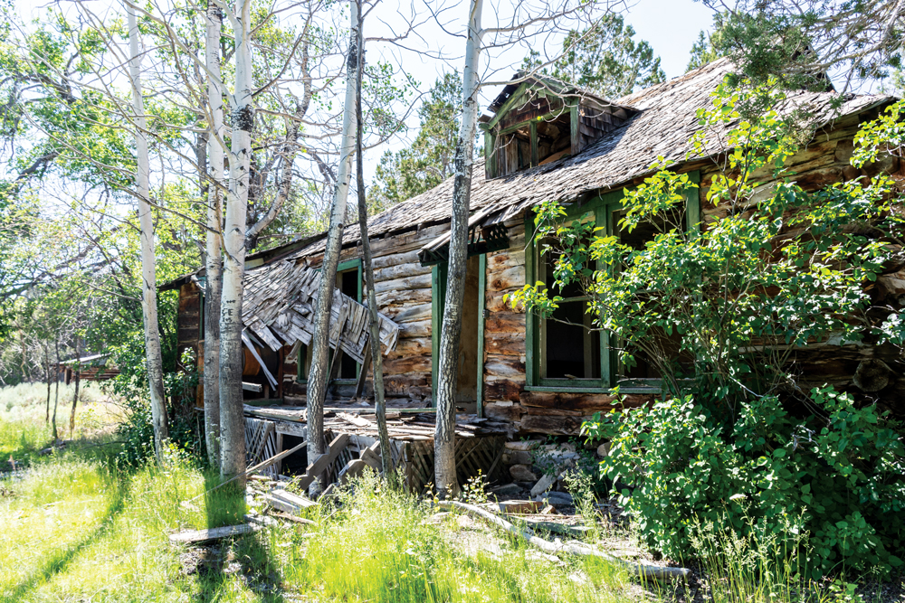
Deer Lodge is unlike any place I’ve been before. It’s incredibly beautiful, yet strangely eerie. A wood and wrought-iron gate adorned with several bleached animal skulls gives off an unpleasant welcome, which is easy to ignore when traversing the towering aspens and bubbling brook. The two-story ranch house is massive, though its fallen into disrepair. Evidence of squatting over the decades is obvious. The deeper we go, the more silent we become. I lack the words to describe how something can be so sinister yet interesting at the same time. The words “CRAMPUS AND THE VIRGIN” are painted atop one bedroom door, and “THE JUDGE” is written on another. This place truly feels haunted.
We decide not to make a major effort to push on to Fay. The road is narrow, and our vehicle isn’t capable. We make the long journey to nearby Caliente, where we grab a bite to eat before retiring for the night.
THE WIDOWMAKER’S NEIGHBOR
Breakfast is enjoyed on the road the following morning, as we head southwest toward the ghost town of Delamar—also known as the widowmaker due to the deadly silica dust produced in its mines. But Delamar isn’t in our sights this trip, rather we seek its neighbor Helene.
Located just 1 mile to the north of Delamar, the Magnolia Gold Mine gave rise to the tent camp of Helene around 1892. Though the operation was much smaller than that of neighboring Delamar, Helene had a post office and a newspaper, called “The Ferguson Lode.” The town was only active for a couple years, fading before the start of the 20th century.
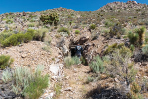
There are several remnants of the town of Helene, including stone buildings, wooden mining structures, and the entrance to the Magnolia Gold Mine. The remains aren’t particularly spectacular, though the view is incredible. Megg and I photograph the mine entrance and an assortment of blooming cacti before pressing on.
HAPPY HIPPIES
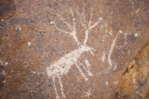
We soon find ourselves barreling up yet another dirt road, this time just on the edge of the Mt. Irish Petroglyph site near Hiko. The area isn’t new to Megg and me, as we’ve been here before years ago, and were turned around due to the incapable vehicle we had taken. This time we’re back with a better vehicle, ready to traverse the absolute sea of petroglyphs that surrounds the road as we search for the ghost town of Logan City. We stop and photograph petroglyphs several times on the way up the canyon before a surprisingly colorful building lets us know we’ve reached our goal.
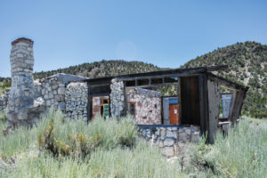
In 1865, rumors of Colorado River silver lured prospectors from the not-so-nearby mining camp of Austin, all the way to the southern river. Much to their disappointment, the prospectors found nothing, and were led back to Austin by a Native American, who took them on a route near Mt. Irish. There, the prospectors stumbled upon a rich silver ledge, though when they tried to mine it in June of the same year, they were attacked by Native Americans and forced to abandon. By fall, the prospectors were back, establishing a more-permanent camp, and grew to a population of more than 300 by 1866. By 1869, most of the veins ran dry, and the population moved to the prosperous Pioche.
There’s not much left of the ghost town to be seen, save several smaller stone structures. There is, however, remains of a house that appears to have been built around the 1960s. Rocks have been stacked, mortared, and painted in a colorful rainbow of hues. A chimney and even remnants of electricity and plumbing can be found in the house, though it’s obvious it hasn’t been occupied for some time. Painted on one of the interior walls  reads the words “ALUM-ALITE ROCK-HOUSE.” I accept that the former residents were getting incredible kicks from things I’ll never know. We soon set our sights on home, and begin making the long journey back.
ANCIENT CRAFT
Charcoal making is dated back to around 4,000 B.C., when ancient Egyptians and Chinese used it for smelting copper. During those days, charcoal was produced by stacking wood, covering it with damp clay, and allowing it to burn slowly. Shortly after, it was discovered that heating copper and tin with charcoal and alloying them would create bronze, which gave rise to the Bronze Age. So much charcoal was used during the late Bronze Age, that forests were near decimation in some parts of the world. Next up was the Iron Age, in which charcoal was used to create widespread iron tools and weapons. Then, sometime during the 9th century, a Chinese alchemist mixed charcoal with saltpeter and sulfur, creating the revolutionary substance gunpowder.
It’s no wonder this incredible ingredient made its way to the Nevada frontier. Next time you fire up your barbecue grill, take some time to appreciate the incredible substance that made smelting possible and allowed Nevada to be called the Silver State, instead of the Silver Ore State.


