Tahoe Rim Trail
Fall 2020
The roughly 170-mile trail provides unrivaled scenery, solitude, and endless adventures and misadventures.
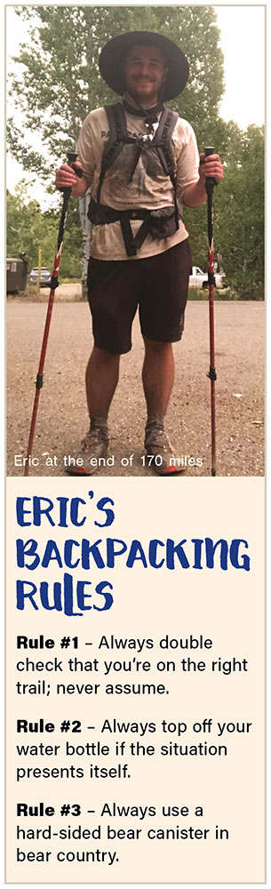
STORY AND PHOTOS BY ERIC CACHINERO
With a gaping hunger hole in my stomach and waning morale, I stare at the absolute chaotic mess on the ground. My wife Jillian and I are 17 miles into the wild and remote Desolation Wilderness, and the destroyed plastic remnants of our nutrition for the next three days stare back at us—an amalgamation of torn Ziploc bags, crushed dehydrated beans, tiny globules of peanut butter and Spam. It is clear that our food storage method has failed, and the cunning persistence of the American black bear has won yet again. We find a solitary 70-calorie packet of tuna with only one bear-tooth mark in it, which we split for breakfast, licking the foil packet clean. We have 16 nearly foodless miles ahead of us on the illustrious Tahoe Rim Trail (TRT), and we’re not letting a little setback like this ruin our trip. More on that to come.
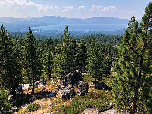
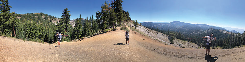
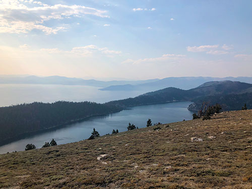
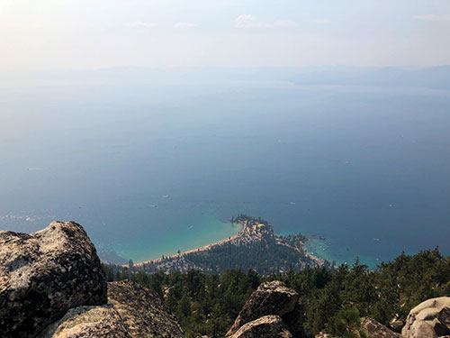
The world-class TRT skirts around 170 miles of the most majestic peaks and valley of the Tahoe Basin, offering incomparable views of Lake Tahoe and the surrounding areas. It crosses six counties, four National Parks, three wilderness areas, two states, and one state park. In August 2020, over nine smoky days, I completed my thru hike (start to finish) of the famous trail. Roughly one-third of the trail exists within the state of Nevada, allowing hikers, backpackers, mountain bikers, and equestrian enthusiasts a chance to explore the trail.
PREPARATION
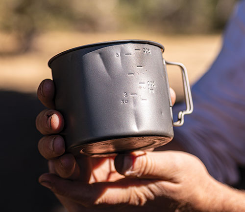
I have been preparing for my TRT thru hike for nearly one year before I actually set foot on the trail. For nearly one year, I obsessed daily about my gear list—shedding three ounces here, two grams there. I tried three different tents before I was satisfied. I switched from a sleeping bag to a much-lighter sleeping quilt. I opted for a frameless backpack. I selected a bear-resistant Kevlar bag over a hard-sided bear canister. Daily, I researched my gear; I would even take my gear out on my lunch breaks or weekday nights to test it out, and my mind constantly swirled with ways to make my pack lighter. What temperature quilt should I use? Do I really need sunscreen? How much of my toothbrush handle should I cut off to save weight? Who really needs two pairs of underwear?
DAY 1
I pull up to the Spooner Summit parking lot at 7 a.m. on Friday, Aug. 28, where I’m greeted by Nevada Magazine Art Director Kippy Spilker and her husband Jeremy, who take some drone and 360-degree-camera footage of the first steps of my journey (visit youtube.com/nevadamagazine to check out the footage). I say goodbye to Kippy and Jeremy, and take my first official steps onto the trail.
 It’s a strange feeling taking the first several steps, knowing that over the next week and a half, I will probably take tens, if not hundreds of thousands more steps.
My pre-hike jitters melt away instantly as I’m swiftly teleported from a world of deadlines and red lights to a world of tranquility. Every sense transforms. Honking horns and sirens are replaced by the repetitive patter of my feet; tiny falling pine needles sound like disintegrating icicles each time a small breeze blows. My sense of smell instantly becomes acute. Scents of pine and juniper replace exhaust and pavement. Infinite green trees replace staring at computer screen. Trail mix and dried mangoes for breakfast replace coffee and office pastries. Fresh naturally cool air replaces the artificial stuff.
The first 16 or so miles traverse a waterless section of Nevada’s western border. The lack of water, however, is supplemented by stunning views of Lake Tahoe. About 6 miles in lies a scenic bench appropriately titled “The Bench.” The Bench offers a welcome rest after the morning climb. I watch boats dance across the lake in the distance.
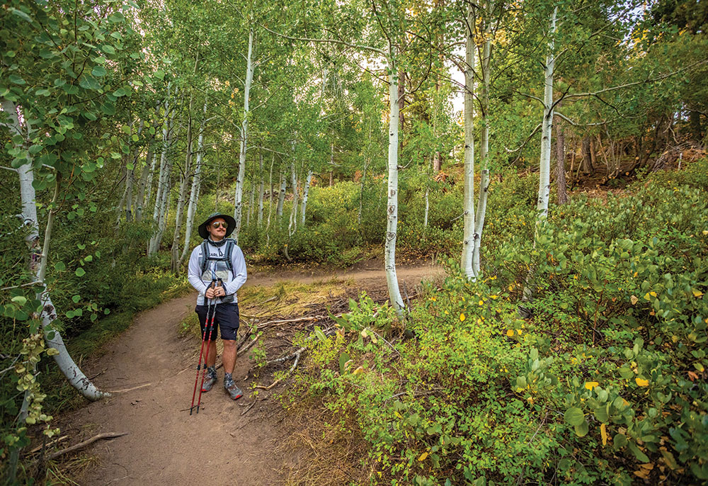
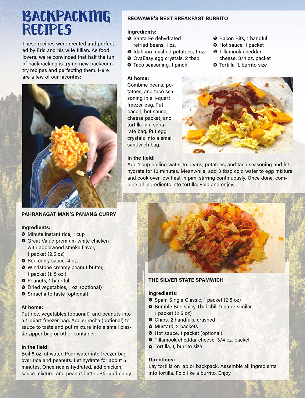
From there, the trail takes me through dense ancient fir forests and granite outcroppings, the whole time playing peekaboo with Lake Tahoe. At about noon, I find a comfortable looking rock to sit on and eat my lunch—The Silver State Spamwich (see sidebar on page 55 for recipe). Chipmunks materialize from every corner of the forest, begging for scraps of my lunch.
The sun is now high in the sky as I finish my sandwich, and I continue on to Kingsbury, where my first water source—Edgewood Creek—awaits. The chilly water is a welcomed respite to the afternoon heat. I sit in the shade and drink cool mountain water. I press on several miles before I watch the last seconds of smoky sunlight disappear behind Tahoe’s western range, knowing that in several days, I’ll find myself in that section of the Sierra.
Day 1 mileage: 17.2
DAY 2
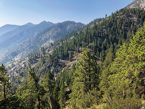
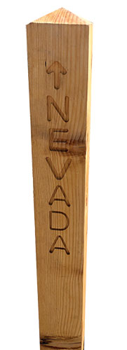
 The next morning I’m up early, packing up my campsite and eating breakfast on the trail. The morning quickly finds me ascending from the Kingsbury South trailhead, located near Heavenly Ski Resort. I have hiked this section several times in the past, though its beauty is never lessened. The trail makes a steep climb before revealing majestic views of the Carson Valley. On clear days, a person could swear they could see across the entire state. Several tiny creeks flow gracefully down the Sierra’s eastern face and into the valley below. I make the climb up Monument Pass, where I say goodbye to the great state of Nevada and head into California, where I will hike for the next several days.
I soon find myself at the picturesque Star Lake. Although I’m only on my second day, I’ve hiked about 27 miles total so far, and am in serious need of a lake bath. I find some rocks to jump off of, and I let the alpine waters cleanse me and my clothes. As my clothes dry, I eat a quick lunch, hydrate, and ponder where I will camp for the night.
The trail leads me higher and higher past Freel Peak, before descending nearly 3 miles to Armstrong Pass. It’s around this point that exhaustion begins creeping up on me, along with the sobering realization that I’m running out of water. I’m about 13 miles into the day when I find myself with about a quarter liter of water in my bottle, and at least 5 miles of steep uphill ahead before I come to a location that potentially has water. If it’s dry, I must press on an additional 2.4 miles to reliable water.
For every mile prior, I had reveled in the intoxicating carefree aspect of beautiful nature; however, I find myself now faced with the real nature—the stone-faced, impolite, doesn’t-care-whether-I-live-or-die nature. I sit down and assess my situation. I know there’s no way I have enough to get to where I need to go, let alone have enough to camp and cook with. I conserve what little water I have, as my dry lips and tongue burn. The sun is starting to set. My body screams at me to sip the little water I have left. I have no choice to press on, though.
Whether by luck or divine intervention, a small, unmapped mountain stream reveals itself about 400 yards off the trail. The climb to the water is steep, though the reward far outweighs the effort. I sit in the sun’s last golden rays, chugging liter after liter of some of the freshest, coldest water I have ever had the pleasure of drinking. I fill my water bottles to the brim before pressing on to my campsite for the night, a place called Saxon Creek, though the creek is dry.
Day 2 mileage: 18.1
DAY 3
 Cheerful and well-hydrated, I take to the trail with a refreshed attitude. I stop along the flowing Grass Lake Creek to make a Beowawe’s Best Breakfast Burrito (see sidebar on page 55 for recipe) before continuing past the Big Meadow Trailhead south near the Carson Range. I pass lake after lake, and the atmosphere takes on a new feel. The trees, moss, and rocks all grow larger; I feel like I’m in the giant redwood forest. Giant aggregate rock masses appear around every curve, looking strangely manmade, though they definitely aren’t.
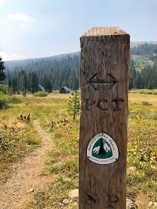
Around noon, my next corner unveils a location on the trail I have been dreaming of visiting. The junction where the TRT meets the Pacific Crest Trail (PCT) reveals itself. For roughly 50 miles, the 2,653-mile PCT, which stretches from Mexico to Canada, and the TRT become one. Suddenly I find myself hiking in beautiful lush meadows, instead of mountain passes. The Upper Truckee River becomes my lunch spot, and I find a rock to sit on while I soak my tired feet in the cold creek.
 From there, I climb a couple miles to the scenic Showers Lake. I take the opportunity to jump in the lake, washing away the trail dust I’ve accumulated from the days prior.
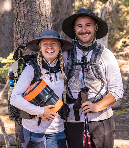
Roughly 7 more miles of rocky terrain lead me to my campsite for the night near Echo Summit. I camp close to Highway 50, because the next morning, I am scheduled to meet up with my wife Jillian. Together, we will set off into the scenic and remote Desolation Wilderness, and a good night’s sleep is vital to our success there.
Day 3 mileage: 19.3
DAY 4
I’m up before the sun and eating breakfast as I hike. I successfully make the mad dash across Highway 50 and climb a mile or so through dense forest and cabins before I arrive at Echo Lake. I meet up with Jillian, who brings me my first resupply, which consists of meals for the next three days. It’s not long before we find ourselves skirting the shale-rock trail that meanders alongside Lower and Upper Echo Lake. Soon we cross into the world-famous Desolation Wilderness, where the beauty and uniqueness of the landscape reveals itself.
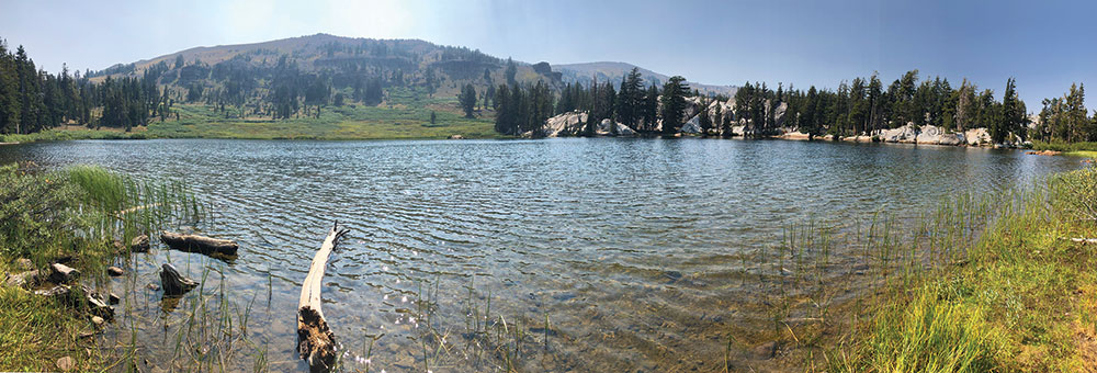
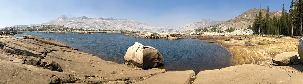
Located at 8,120 feet elevation, Lake Aloha presents unmatched magnificence. Amid the vast and nearly vegetation-free granite background, the lake appears as almost something out of a Sci-Fi film. Crystal-blue waters are interrupted at random by dozens, if not hundreds, of tiny “islands” in every direction. Desolation Wilderness is truly the land that goes on forever and ever.
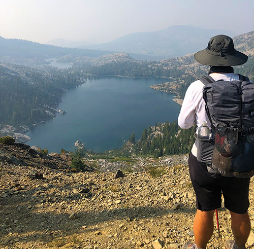 Morale is high and water is plentiful as we continue through the wilderness area. There is a new lake, stream, or pond around every turn. Hiking here feels like living in a painting. Each time I think the Sierra couldn’t possibly get more entrancing, it proves me wrong with nearly each step. I understand why this area is protected.
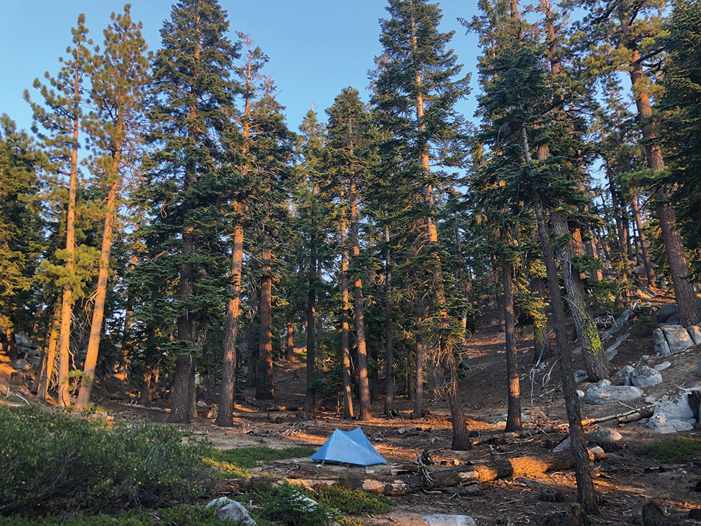
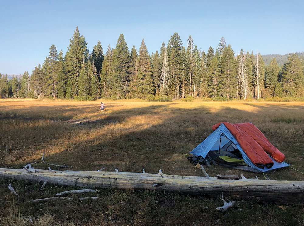
Jillian and I make the steep climb up Dick’s Pass, where we are able to gaze upon our destination for the night: Fontanillis Lake. I make a quick attempt to count the number of lakes I can see from the top of the pass, before I realize the effort is fruitless due to the amount. We continue on to the lake’s edge, where we make our camp amid the unmatched beauty that Fontanillis affords us. We cook our Pahranagat Man’s Panang Curry (see sidebar on page 55 for recipe), before we pack all of our food, cookware, first-aid kits, and toiletries into our bear-proof bags. After the sun goes down, we hike about 150 yards, tie our bags off to a pine tree, and return to camp, blissfully unaware of the rude awakening that would greet us the following morning.
Day 4 mileage: 18.2
DAY 5
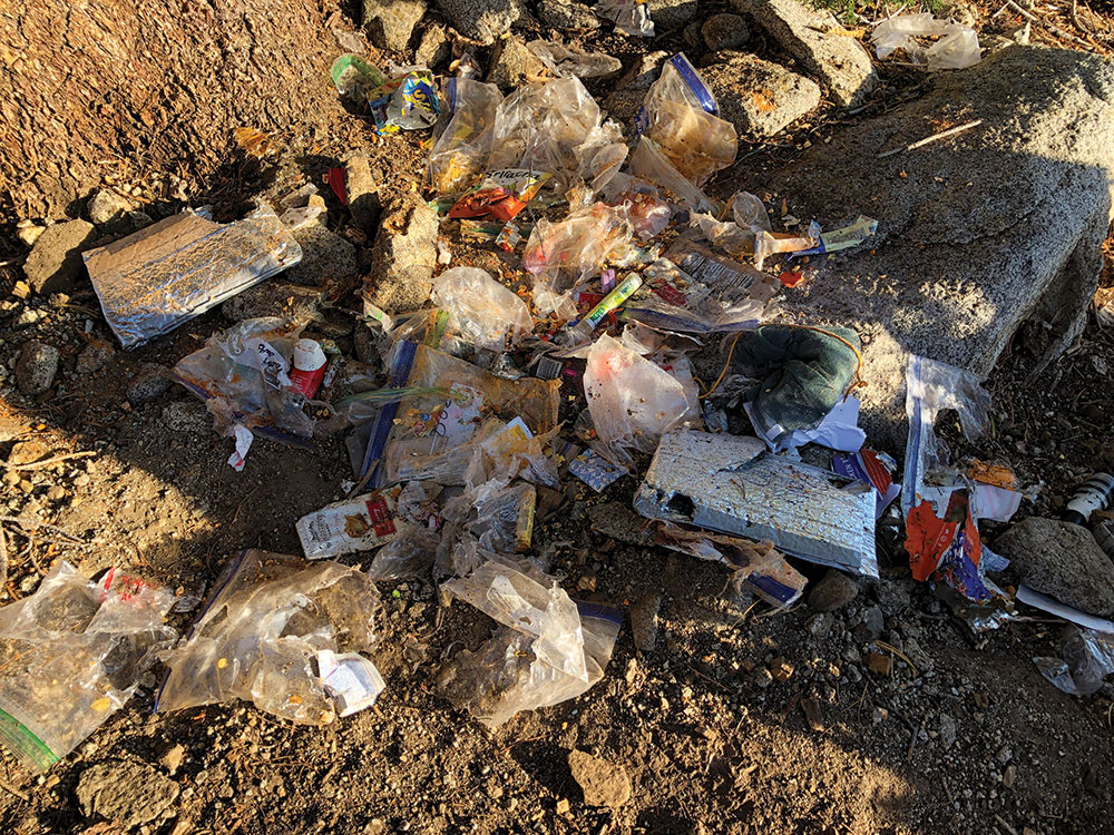
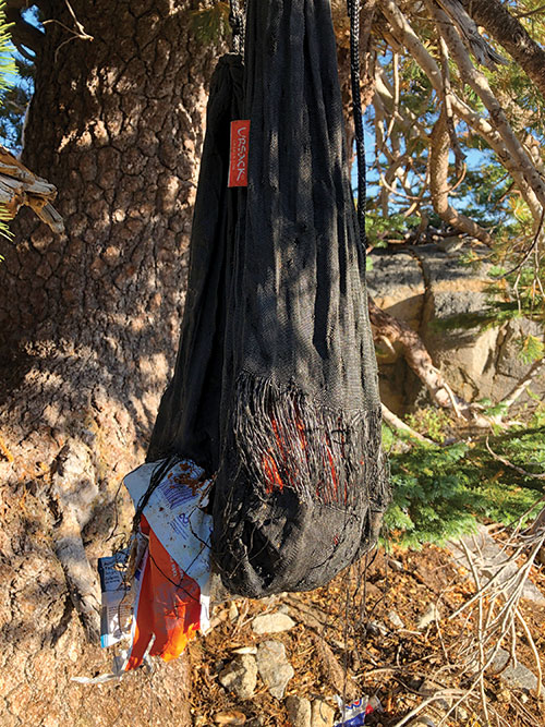 About 10 peaceful, short minutes exist between the time we open our eyes, and the moment we lay them upon the bear’s wreckage. The bear has torn through not just one, but two bear-resistant Kevlar bear bags, and devoured nearly every morsel of food inside. The bags are designed to be tied to a tree branch, and bears are supposedly unable to tear through the fabric, which was historically used to make bullet-proof vests.
In all, the bear ate about 10-12 meals, and seriously damaged the inedible items. Claw and teeth marks mar our titanium cook pots and our first-aid kits are ripped to shreds. Perhaps the most insulting aspect of the entire pickle, though, is a large pile of the stinky digested remains of our food that lies perfectly in the middle of the wreckage.
As I reach up to untie the tattered bag from the tree, I struggle for a minute to loosen the knots. As I step back down, my foot comes into swift and squishy direct contact with the digested remains, and I stand for a couple seconds in disbelief, conflicted on whether I should laugh hysterically or utter a couple strong words.

Jillian and I assess the situation and realize that if we’re going to get through the approximately 16 nearly foodless miles ahead of us, we need to remain in good spirits no matter what. We climb atop a couple nearby granite outcrops, and luckily find some scant cellphone service. Jillian’s mom Susan luckily answers the phone and offers to be our trail angel/superwoman for the day, agreeing to meet us at Barker Pass with two large burritos each, along with a new bear bag and food to get us through the next couple days.
After washing my foot off in Fontanillis Lake and scarfing down the tuna fish—about 35 calories each—and a small bit of coffee, we set out on the trail. Something strange happens to the brain when you exercise hard with no nutrition. I don’t feel exhausted; in fact, I feel full of energy at times. Mostly what I feel is more just generally loopy—time seems distorted, as does my focus. Though we’re hungry, Jillian and I joke about the situation for hours while we hike. The trail leads us through miles and miles of wooded area, though the hunger and tunnel vision cause me not to look around at the scenery much.
After what seems like an eternity—and while successfully maintaining good spirits all day—we finally reach Barker Pass and…Susan is nowhere to be found. We try calling frantically over and over…nothing. Then, just as the sun begins to fade and we game plan our emergency exit 2.0, we see her car crest the hill, and a wave of relief washes over us.
Jillian and I shamelessly ugly-eat our burritos, sauce and cheese running down our cheeks. I can only imagine we look like crazy people devouring bite after bite, as the stench and grime of dozens of miles of dirty hiking is clear as day.
We hang our food in a tree using a traditional bear-bagging method, which takes nearly 30-minutes to find a suitable location. Luckily, though, we climb into our tent with full bellies.
Day 5 mileage: 15.7
DAY 6
I sleep horribly.
I experience endless anxiety throughout the night, wondering how I’m going to pull off hanging a bear bag each of the following nights of the trip. It’s 6 a.m., and I’m outside the tent pacing back and forth, pondering my next move. What I need is a hard-sided bear canister, but the logistics of picking one up while on trail seem near impossible.
In a eureka moment, I’m reminded that Kippy’s husband Jeremy is a backpacker, and in the past Kippy offered to let me borrow gear should I ever need it. I text Kippy asking if they own a bear canister, and by some miracle, she responds immediately saying that they do. Furthermore, she offers to drive it all the way to our location, which is a big deal considering we’re pretty much at the farthest point on the TRT away from Carson City as possible. Within a couple hours, though, Kippy—our second trail angel—shows up with bear canister in-hand, effectively saving the rest of the trip.
With newfound optimism and a proper food-storage method, Jillian and I set off on the rest of the trail, giddy at our stroke of good luck. The day leads us to some of the most scenic views of the entire trail, with endless panoramic views of Lake Tahoe. We leisurely hike only around 14 miles for the day, giving our bodies a chance to heal. Eventually we cross the flowing Ward Creek, where we spend an hour soaking feet and spotting the friendly and fearless brook and rainbow trout that almost swim all the way up to our toes.
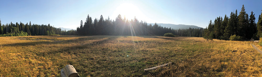
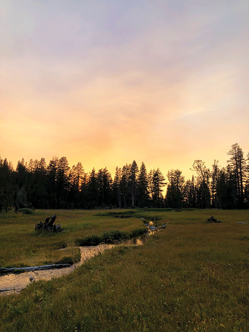
The beautiful Page Meadow becomes our camp for the night.
Day 6 mileage: 14
DAY 7
The bear canister works like a dream.
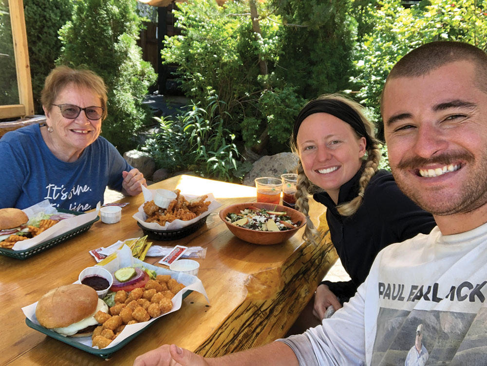
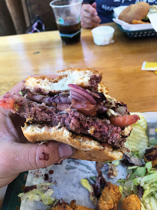
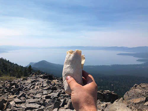
We awake and make the short trek into Tahoe City, where we have an early lunch planned with my grandmother Roxy. She is our third trail angel of the trip, resupplying me with the food that I need for the remainder of the journey. We meet at the Bridgetender restaurant in Tahoe City, where I proceed to eat an entire 1/3-pound burger, a massive pile of tater tots, and several handfuls of garlic fries.
 After lunch, I bid farewell to my wife and my grandmother, as I’m tackling the rest of the trail solo. I take a dip in the Truckee River before stepping back on trail, but it becomes immediately clear that I have encountered another problem.
I’m full. Absolutely uncomfortably stuffed to the brim. It is decidedly opposite of the problem I had encountered on day 5, though it’s just as debilitating. It’s incredibly difficult to hike up mountains when my stomach is this full. I find myself grunting and groaning as I climb higher and higher out of the Tahoe Basin and onto the rim. It takes me most of the afternoon to start feeling normal again.
I meet a trail friend from Texas along the way who is thru hiking the trail. We hike for a couple miles together before reaching Watson Lake on the northern edge of the Tahoe Basin. I hike several miles past the lake before I find a small outcropping to make my camp.
Day 7 mileage: 19
DAY 8
Climbing is the name of the game today. I have about 3,000 vertical feet to cover over a distance of about 16 miles, with no water sources in between. Knowing this, I cached (hid) a gallon of water in the woods near Brockway Summit before I started the hike. I cover the first 5 miles quickly, eventually reuniting with my cache, which I proceed to chug half, and load half into my bottles and spare water bladder.
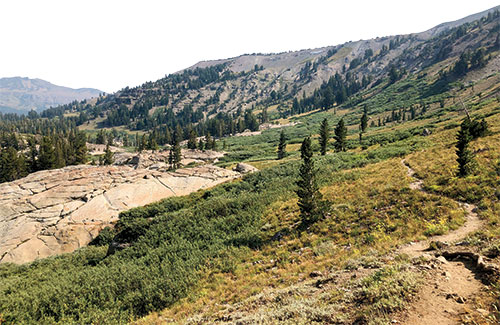
 The climbing is tough, and the temperatures rise to uncomfortable levels around 10 a.m. I make my way to the summit of Mt. Baldy, and the trail reunites me with the state I love the most (Nevada, of course). Soon I find myself hiking in the gorgeous Mt. Rose Wilderness, with spectacular views of Incline Village and the lake.
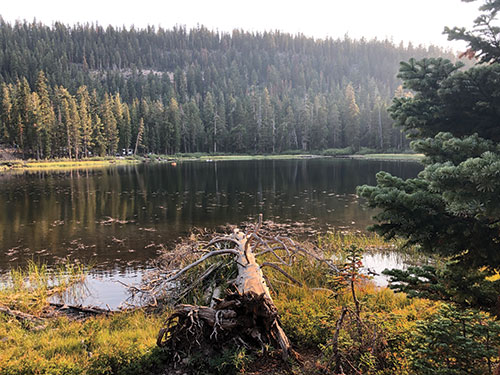
 It’s at this point that I start feeling the trail weighing on me. I’ve been hiking nearly 20 miles every day, all day for a week. My legs and feet are sore, and my thighs are suffering from uncomfortable chafing. I decide I need to let my body rest if I am going to continue the trek. I find myself off-trail at the small but beautiful Gray Lake at around 2 p.m., and I decide to call it quits for the day. I lay in the cool meadow grass and cat nap, taking occasional breaks to drink from the lake’s frigid inlet. I have the entire area to myself, and I take full advantage of the soothing solace.
For dinner I eat my very first ramen bomb, which consists of an entire package of Top Ramen, an entire package of dried mashed potatoes, and an entire package of Spam all mixed together. I find myself in my tent before the sun even sets.
Day 8 mileage: 15.3
 DAY 9
DAY 9
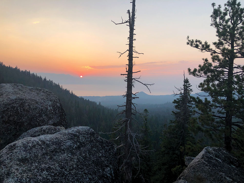
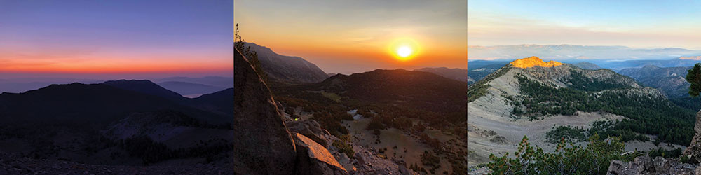
My alarm blares at 4 a.m. My plan is to watch the sunrise from the highest point on the TRT—the 10,338-foot Relay Peak. This is the first morning that I am hiking completely in the dark, and it’s actually really fun. It is absolutely pitch black out, and I take turns hiking with my headlamp on, and turning it off to hike in the darkness. The peak is about 4.5 miles from my campsite and about 1,000-feet elevation gain, so I hike fast to be sure I get there in time. The first rays of dawn begin to reveal themselves just as I reach the top of the peak. After chatting with a group of four women thru hikers that camped atop the peak, all of whom were older than 70, I find a secluded spot to make some coffee and eat my breakfast as I watch the sunrise. The smoke from regional wildfires compounds the sun’s beauty. I can see the farthest reaches in every direction; I feel on top of the world. The experience is spiritual.
The journey down the other side of Relay Peak is equally scenic, and views of Mt. Rose reveal themselves. Once I reach Galena Falls, the trail experience changes dramatically. From Galena Falls to Mt. Rose Highway, a distance of about 2.4 miles, I pass more people than I had on the entirety of the rest of the trail.
I experience similar crowds in Tahoe Meadows, though the farther I get, the more they thin out. It’s a strange shock to the system to be alone for days at a time, then suddenly surrounded by people.
I realize that it’s 9 a.m., and I’ve already hiked 10 miles for the day. Originally, I had planned on taking 10 days to complete the trail; however, with the finish line in sight and an already spectacular start to the day, I decide I want to go big. If I reach Spooner today, it will have been around 37 miles hiked in a single day, a major record for me.
Let’s do it.
I pick up the pace as the trail starts to weave me back and forth between views of Washoe Lake and Lake Tahoe. For the first time during the trip, I view the trail as a challenge I must overcome, rather than solely for enjoyment.
I give myself 15 minutes to eat lunch, and realize I haven’t taken a single break since 4 a.m. except to eat breakfast.
I push farther and farther, even taking a 1.2-mile detour to experience Christopher’s Loop, which offers incredible views overlooking Sand Harbor. Eventually I find myself at Marlette Campground, which offers a hand-pump well, and I gladly employ it to fill my water bottles. With around 9 miles left of my trip, I can almost taste the cold beer waiting for me at the end, but I’m not quite there yet. The trail takes me higher near Snow Valley Peak, and the smoke from the wildfires takes a dramatic turn. It becomes so dense that I can no longer see the sun, and it’s only
around 5 p.m.
Right around mile 30 for the day, exhaustion sets in. My entire body aches, and my mind becomes blurry. Luckily, it’s mostly downhill on the last stretch. “Just one more mile,” I repeat to myself over and over.
I’ve taken hundreds of thousands of steps over the past 9 days, and I take the final one with pride. And just like that, I’m back at my car. 170 miles. 37.4 miles in a single day. I’m done.
Day 9 mileage: 37.4
AFOOT AND LIGHTHEARTED
In 170 miles, I experienced nearly 24,400 feet of elevation change. I climbed peaks higher than 10,000 feet. I met more people in their 70s thru hiking than I did in their 20s and 30s combined.
The trail exists for all, and will remain for all, always. The day hiker can find solace on the trail, as can the thru hiker. The trail asks nothing of you, save respect, and offers everything in return.