Sweetwater Mountains
November – December 2013
Life and wonder in the Sweetwater Mountains
BY SCOTT NEUFFER | NOVEMBER/DECEMBER 2013
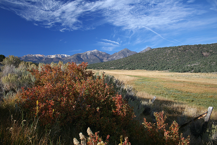
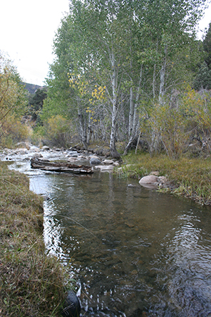
In the night, lying in the open, we threw human questions against the deep, starry vastness of Nevada sky. Questions of time and fate, loss and memory. The wind rushed in the tall aspen beside the creek. Random stars streaked and sputtered across the sky—like quick, brilliant memories disappearing the instant we beheld them. We had come to this corner of Nevada so many times over the years. Like so much of the state, it offered solitude and rare beauty in which we could ask questions and search out echoes of ourselves in the landscape. The creek ran through our dreams as we fell asleep under the stars. In the morning, we awoke to the same sound of running water. The cold air carried the smell of sagebrush, as if the familiar scent were an answer to the night’s perplexities. The willows around our camp burned pale gold in their autumn foliage, along with pockets of aspen leaves just yellowing. Their answer was one of change, soft and tremulous against the bare mountains beyond…
You first notice the Sweetwater Mountains driving south from Gardnerville on Highway 395. Snowcapped most of the year, they appear like lofty clouds on the horizon. Yet closer to Topaz Lake, their foothills and canyons sharpen with sinewy dimension, are stippled with piňon pine and juniper. The white clouds are really mountaintops that straddle eastern California and the western edge of Nevada.
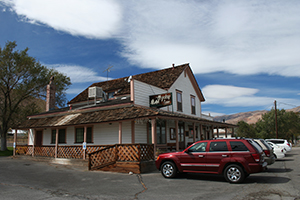
To get there, turn left on Highway 208 before Topaz Lake and follow the West Walker River into Smith Valley. The Sweetwaters disappear for a while, but views of the small farming community more than compensate. Irrigated alfalfa fields and grandfatherly cottonwood trees soften the desert hills rimming the valley. Keep right on Highway 829 through the quiet town of Wellington and notice historic sites like the Heyday Inn. Constructed in 1875 as a store and hotel, the Heyday once served those heading south to the mining fields of Bodie and Aurora. Its restaurant now serves some of the finest Basque cuisine in the state.
At the end of Wellington, steer right on Highway 338 toward Bridgeport, Calif. Desert Creek is the main camping area on the Nevada side of the Sweetwater Mountains. There are two entrances to this cold mountain stream that tumbles down from Lobdell Lake in California. Just past Wellington, Desert Creek Road stretches long and lonely across a sagebrush plain toward the sculpted roundness of Desert Creek Peak. If you turn right, you’ll hit the mountains in five minutes and then climb up a rocky, steep-walled canyon to a spare Forest Service campground. Ancient petroglyphs adorn volcanic boulders at the mouth
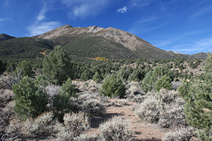
of the canyon. If you opt for the second entrance and follow Highway 338 another 15 minutes south, you’ll wind through humming hills of piňon pine, pass old homesteads sunk in shallow meadows, then suddenly find yourself dwarfed by the radiant thrust of the Sweetwater range.
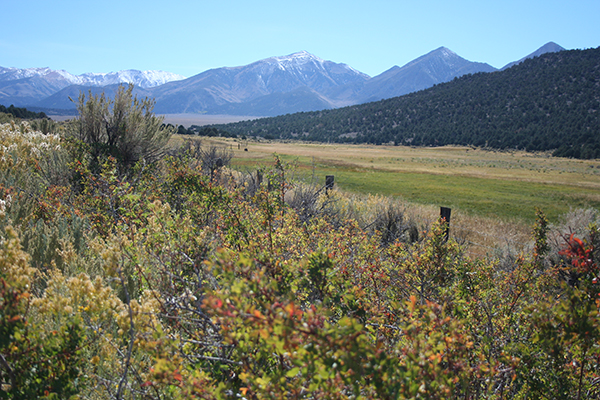
Of the three Sister peaks cutting the sky, only East Sister resides in Nevada, reaching 10,402 feet. South Sister is the tallest of the three, standing at 11,339 feet. Further south, the snow-draped glaciation of Mt. Patterson and Wheeler Peak both push 11,600 feet. The various types of rock in the mountains, from Sierra-like granite to volcanic rhyolite and basalt, create a complexity of colors: bone-whites, slate-blues, luminous pinks and browns. Likewise, the various flora of the range adds intense texture: knotty piňon pines, leafy aspen, even delicate fir trees in the higher, wetter glades. The southern flanks in California feed the East Walker River and resemble the adjacent Sierra Nevada. The northern flanks in Nevada, though rich and diverse with life, begin to mirror the rain-shadow desert into which Desert Creek empties and eventually finds its way to the West Walker River. If you follow Highway 338 further south, you’ll find sweeping, breath-taking ranches all the way to Bridgeport, including the Rosaschi Ranch on the East Walker, famed for its trout water. On the higher slopes of the California side sit the ghostly ruins of mining camps, like the abandoned town of Belfort that lies in the shadow of Mt. Patterson. If instead you turn right on Risue Canyon Road (Forest Service 050), the first right after the mountains break into view, you’ll found yourself driving through the sagey benches and piney canyons of the south entrance to Desert Creek. Both entrances in Nevada necessitate four-wheel-drive vehicles with high clearance.
On the last weekend of September, my father and I took this second entrance, as we always have. Our desire to see the mountains in full view trumped everything else. Others had the same idea. We followed pick-ups with campers and ATV trailers, and even some cowboys towing their horses for the fall roundup in the high country. When we reached the creek, most of them turned right, downstream, toward the Forest Service campground. We turned left, crossing the creek twice and navigating a rough patch of small boulders. We’d been hoping for autumn color and weren’t disappointed to find golden willow and some quaking aspen just turning yellow at their edges. But we couldn’t make it to our old camp site. The road had become too rough, our vehicle too frail.
We found a grassy spot along the creek and unloaded our provisions for the night. We didn’t bring poles but immediately saw trout zipping through the clear pools. The Nevada Department of Wildlife routinely stocks the creek with browns, brooks and rainbows, making for some of the best stream fishing in the state. Before the sun fell behind the mountains, we hiked up to our old camp spot at the end of the road. As soon as we saw it, a distinct slice of meadow in a stand of aspen and Jeffrey pine, we were both floored by the paradoxes of time. My father was silent. I saw myself 20 years ago, at the age of 11, scrambling up the canyon wall with my brothers, heading for the morning light on the bare slopes of East Sister soaring beyond. We had forgotten this place. It had disappeared from our lives. Yet now, two decades later, it burned just as freshly in our minds. How could something be so far and so close at the same time? How could so many years pass in the blink of an eye?
These were questions we asked the Nevada sky that night lying in our sleeping bags, forgoing the comfort of a tent. For us, such openness is sacred. We’ve found that the state itself is one giant sounding board of desert, mountains and sky—this particular spot a chapel of aspen and willow fed by the holy waters of a mountain stream. Desert Creek, like much of the state, offers silence and clarity for those prepared to listen. We listened and heard echoes of our former selves playing across the sky. Then just the sound of wind animating leaves. Cold water running over stones.
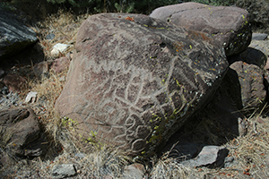
In the morning, we headed back toward Smith Valley. We took a detour up to the north entrance of Desert Creek and pondered the petroglyphs carved in basalt boulders at the mouth of the canyon. Cursory research reveals their origin is unknown yet likely prehistoric, predating existing tribes of Native Americans. Some of the symbols are curved and connected like a trail on a map. Others seem more discrete and inscrutable, as if to mark some intense, bewildering passion.
We left the creek in the rearview mirror and headed for the Heyday Inn. Before we lost ourselves in the warmth and comfort of a hearty lunch, we reflected on the rugged place we’d been compelled to revisit. It is a place of strange colors and textures at once austere and vibrant, a place simultaneously lonesome and intimate with the mysteries of nature. Above all, it is a place where lives lost and regained in the landscape become the things of myth.
Resources
Humboldt-Toiyabe National Forest: Desert Creek Campground
http://www.fs.usda.gov/recarea/htnf/recarea/?recid=65284
Nevada Department of Wildlife: Desert Creek
http://www.ndow.org/Bodies_Of_Water/Desert_Creek/
The Heyday Inn
http://www.heydayinn.com/
